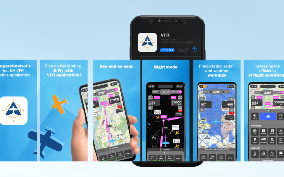
HungaroControl launched the VFR mobile application developed by R-SYS
HungaroControl, the Air Navigation Services Provider (ANSP) in Hungary, uses the NetBriefing web service for flight plan management, pre-flight briefing, and communication with pilots. Developed by R-SYS, a subsidiary of ERA, this innovative system acts as the data source for a cutting-edge VFR mobile application, designed to enhance pilots' situational awareness and streamline support for their planned flights. Launched in early July 2024, the application is compatible with both iOS and Android platforms.
Advantages of the VFR mobile application
The Netbriefing web console offers extensive capabilities for pre-flight briefing, flight plan creation and submission by pilots, and their management and approval by the ANSP. The VFR mobile application goes even further by providing pilots access to these same functionalities as well as real-time navigation information and the position of other aircraft and drones in the vicinity. This versatile application collects, distributes, and displays all relevant aviation data. Users will particularly appreciate features that enhance situational awareness of current airspace conditions based on sharing and displaying static and dynamic airspace data as well as positions of other aircraft and drones.
"The mobile application provides pilots with comprehensive information on flight operations and real-time METEO data, as well as the capability to share their locations, significantly enhancing airspace safety. This initiative marks a significant step forward in the digital transformation and modernisation of Hungarian aviation,“ stated György Blazsovszky from HungaroControl.
For whom is the application designed?
The application is designed for a wide range of airspace users, offering a selection of flight profiles that define the type of aircraft and flight, such as single/multi-engine piston, glider plane, paragliding, hang glider, motorized paraglider, hot air balloon, helicopter, ultralight, RC model, and drones. Registered users can use the application solely for private purposes; commercial use is not permitted.
Features of the VFR mobile application
The application presents data on Hungary's light and dark base maps, using a digital topographic model of terrain relief DDM-50 accessible offline. Alongside static and dynamic (FUA) airspace details, it indicates the status of active online drone zones, provides updated AIRAC digital information, EAD data, precise METEO data from HungaroMet (including precipitation radar, satellite imagery, and warning forecasts), and AIP documents.
The application logs records for every flight, allowing pilots to review them for flight assessment or debriefing within the NetBriefing system. During flight, aircraft position data (from GNSS) are transmitted via mobile networks, visible to other users. The VFR mobile application provides a flight plan route overview on the map, and facilitates flight initiation from a list of plans created in NetBriefing. Users can submit flight plan-related messages DEP, ARR, CNL, CHG, and DLA to ARO.
As of July 2024 the navigation, pre-flight briefing and in-flight information functions are still in test mode, meaning the validity of information displayed is not guaranteed. The information shown covers information on the Hungarian airspace. The flight plan creation and submission works as a live system with the limitations of mobile coverage.
"In developing the application, we prioritised the provision of comprehensive data alongside a user-friendly and practical design and data presentation. We are pleased that many pilots have quickly adopted the application and are using it for safe flight operations," noted Pavol Serbín, Business Director at R-SYS.

